Grand Theft Auto VI releases on November 19, 2026, for PS5 and Xbox Series X|S, and Rockstar has already revealed plenty about its massive open world. The game takes players back to Vice City while expanding far beyond it with swamps, islands, industrial towns, mountains, lakes, and several new regions. If you are looking for the complete GTA 6 map, this guide covers every confirmed location, map size estimate, and all the latest discoveries.
Rockstar made the GTA 6 pre-orders live on June 25, while also revealing a lot of details. Combined with years of work by the GTA mapping community, players now have the clearest picture yet of Rockstar’s biggest open world.
Our guide gathers all the official information from Rockstar Games, including both trailers, promotional screenshots, and cover art details. We also analyzed the latest State of Leonida mapping project data to bring together everything currently known about the GTA VI map.
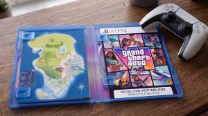
Editor’s Note: We updated this Grand Theft Auto 6 map guide in June 2026. Rockstar has not officially revealed the complete GTA 6 world map. Any information marked as “Rumored” comes from community discoveries, mapping projects, or unofficial findings and should be treated accordingly.
Where Is the GTA 6 Map Set?
The GTA 6 map is set in the fictional state of Leonida, Rockstar’s interpretation of Florida. This state expands the Vice City region into more fresh GTA game locations. That includes dense urban districts, coastal towns, massive wetlands, industrial regions, mountain forests, tropical islands, and numerous smaller communities.
As we all can expect, Vice City remains the centerpiece of Leonida, inspired by modern Miami with its beaches, nightlife, luxury districts, ports, and towering skyline. Trailer 2 expanded the world considerably by revealing more highways, countryside, rivers, lakes, factories, wildlife, and residential areas outside the city.

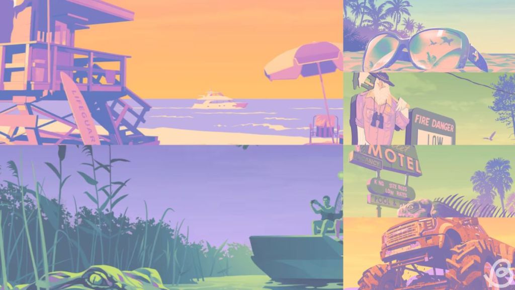
The latest community reconstruction also paints a much clearer picture of how Leonida is connected. Rather than being a single large city, the state appears to be divided into multiple counties linked by interstate highways, waterways, bridges, and long rural roads.
The current reconstruction places Mount Kalaga across the northern border, Port Gellhorn on the west coast, Ambrosia beside Lake Leonida, Vice City on the southeast shoreline, Grassrivers throughout the southwest, and the Leonida Keys stretching across the southern islands.
Rockstar has also referenced another neighboring state called Gloriana through vehicle license plates and road signs. While this confirms its existence within the universe of the GTA games, the studio has yet to reveal whether players will actually be able to travel there.
GTA 6 Map Locations
Rockstar has officially confirmed six major regions within Leonida, alongside several counties, cities, and landmarks. These locations already make GTA 6 one of the most geographically diverse games the developers have ever created.
| Location | Status | Type |
|---|---|---|
| Kelly County | Confirmed | County |
| Leonard County | Confirmed | County |
| Vice-Dale County | Confirmed | County |
| Vice City | Confirmed | City |
| Port Gellhorn | Confirmed | City |
| Ambrosia | Confirmed | Industrial Town |
| Jason’s Safehouse | Confirmed | Landmark |
| Grassrivers | Confirmed | Wetlands |
| Leonida Keys | Confirmed | Tropical Archipelago |
| Mount Kalaga National Park | Confirmed | National Park |
| Lake Leonida | Confirmed | Lake |
| Ocean Beach | Confirmed | Landmark |
| Vice Beach | Confirmed | Landmark |
| Ocean Drive | Confirmed | Landmark |
| Vice City International Airport | Confirmed | Airport |
| Vice City Port | Confirmed | Port |
| Malibu Club | Confirmed | Landmark |
| Monument of Leonida | Confirmed | Landmark |
| South Tower | Confirmed | Landmark |
| Starlet Motel | Confirmed | Landmark |
| Goodtime | Confirmed | State |
| Delights Cabaret | Confirmed | Landmark |
| Underwater Areas | Confirmed | Landmark |
| The Rusty Anchor | Confirmed | Landmark |
| Vercetti Estate | Confirmed | Landmark |
| PTT YOUNGIN$ Illegal Goods Store | Confirmed | Landmark |
| Sara’s Unisex Salon | Confirmed | Landmark |
| Rideout Customs | Confirmed | Landmark |
| Paradise Garage | Confirmed | Landmark |
| Stock 305 | Confirmed | Landmark |
| Electric Fang Tattoo | Confirmed | Landmark |
| One-Eyed Willie’s | Confirmed | Landmark |
| Sheriffs Office | Confirmed | Landmark |
| Little Haiti | Rumored | District |
| Leaf Links | Rumored | District |
| Rockridge | Rumored | District |
| South Beach | Rumored | District |
| Washington Beach | Rumored | District |
| North Beaches | Rumored | District |
| Yorktown | Rumored | Town |
| Red Hill Forest | Rumored | Forest |
| Ekanfinaka | Rumored | Area |
| Hamlet | Rumored | Community |
| Stockyard | Rumored | District |
| Venetian Islands | Rumored | Islands |
GTA 6 Map Major Regions and Landmarks
Now that you know about all the confirmed and rumored parts of the GTA 6 map, let us take you through all the major regions and landmarks available in each. This includes the locked locations you can only get from the GTA 6 Ultimate Edition.
Vice City
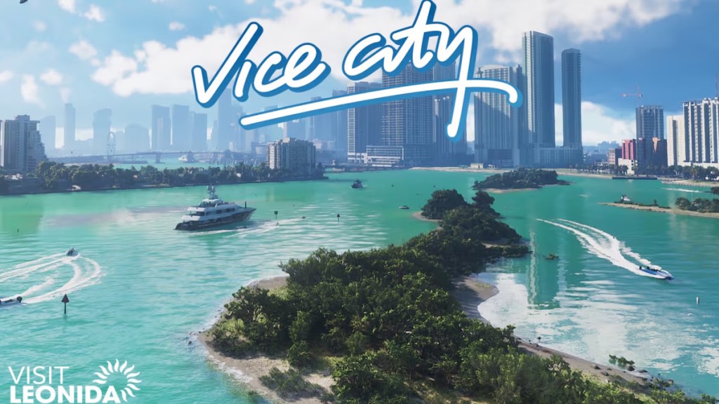
Vice City is Leonida’s largest city and serves as the game’s primary urban setting. The city combines luxury neighborhoods, crowded beaches, nightlife, ports, business districts, and dense residential streets. All trailers, GTA 6 cover art, and latest website screenshots reveal a far larger and more detailed version of Vice City than anything seen in previous Grand Theft Auto games.
Here is the list of all confirmed and rumored areas from this region in the game:
- Ocean Beach
- Vice Beach
- Ocean Drive
- Vice City Port
- Vice City International Airport
- Jason’s Safehouse
- Malibu Club
- Monument of Leonida
- South Tower
- Vercetti Estate
- PTT YOUNGIN$ Illegal Goods Store
- Rideout Customs
- Sara’s Unisex Salon
- Little Haiti (rumored)
- Leaf Links (rumored)
- Rockridge (rumored)
- Washington Beach (rumored)
- South Beach (rumored)
- North Beaches (rumored)
- Stockyard (rumored)
- Venetian Islands (rumored)


Port Gellhorn
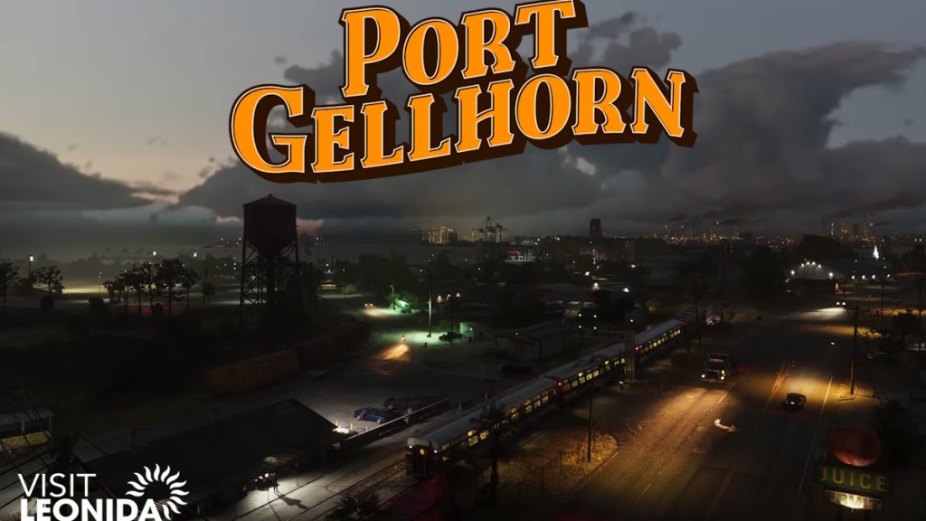
Port Gellhorn represents Leonida’s forgotten West Coast. Official artwork shows abandoned attractions, industrial docks, truck stops, motels, warehouses, and working rail lines replacing traditional tourist hotspots. The latest mapping project suggests the city serves as one of the state’s primary shipping and industrial centers.
- Yorktown (rumored)
- Starlet Motel
- Delights Cabaret
- Western coastline
- Industrial docks
- Highway network
- Coastal wetlands


Ambrosia
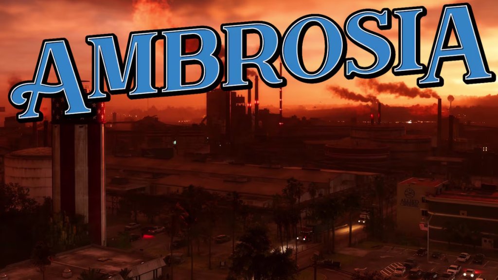
Located beside Lake Leonida, Ambrosia serves as Leonida’s industrial center. The Allied Crystal sugar refinery dominates the skyline, while highways, farmland, railroads, and factories surround the town. Rockstar also hints that biker gangs maintain a significant presence throughout the region.
- Allied Crystal Sugar Refinery
- Lake Leonida
- Agricultural fields
- Sheriffs Office
- Industrial district
- Highway interchange


Grassrivers
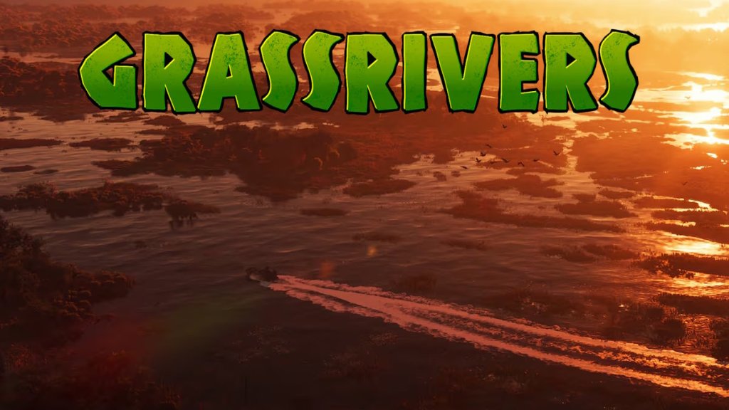
Inspired by Florida’s Everglades, Grassrivers appears to be one of GTA 6’s largest natural regions. The area consists of swamps, mangroves, rivers, marshes, wildlife habitats, and hidden waterways. Rockstar has already shown airboats, alligators, wetlands, and dense vegetation throughout the region.
- Paradise Garage
- Watson Bay
- Wetlands
- Mangrove forests
- Marshlands
- Wildlife reserves


Leonida Keys
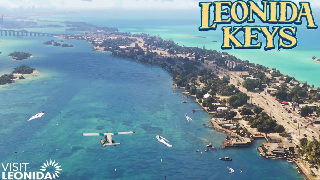
Leonida Keys recreates the Florida Keys with tropical islands connected through long bridges and coastal highways. Trailer 2 suggests that Jason and Lucia’s early safehouse may be located within this region. As per the community mapping project, several populated islands are connected across the southern edge of the map.
- Key Lento
- Stock 305
- Electric Fang Tattoo
- One-Eyed Willie’s
- Airward Key
- Key West equivalent
- Southern bridges
- Underwater Areas
- The Rusty Anchor
- Island communities


Mount Kalaga National Park
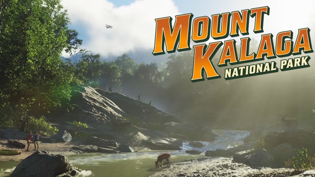
Mount Kalaga National Park dominates Leonida’s northern border and introduces forests, mountains, rivers, hiking trails, and off-road routes. Unlike Vice City’s urban environment, this area focuses on wilderness exploration, hunting, fishing, and remote communities.
- Mountain forests
- River valleys
- Hunting trails
- Off-road routes
- Northern state border
- Gloriana border (unconfirmed)


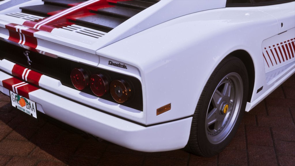
There is also a state named Goodtime, as per the Ultimate Edition locked items in GTA 6. This name appears on a paid car’s license plate. We will add more information about this place when we find out more.
GTA 6 Map Size
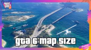
One of the biggest questions surrounding the GTA VI map is just how large it will be. Current information about the world’s exact dimensions remains speculative. However, every official trailer, screenshot, and promotional image points toward the studio’s biggest and most varied open world to date.
Current estimates from the GTA mapping community suggest the GTA 6 map could be approximately 1.5 to 2 times larger than GTA 5’s San Andreas. These estimates come from years of analyzing all screenshots and environmental details. No announcement has been made about the final size.
The latest theories also suggest a much denser highway network than previous GTA games. Long interstate roads connect every major region, while rivers, canals, bridges, railways, airports, ports, and smaller settlements create a world that appears far more interconnected than Los Santos.
Rockstar has also significantly expanded environmental diversity. Instead of focusing primarily on a single metropolitan area, Leonida combines different types of terrains. This variety should make traveling across Leonida in your favorite GTA 6 cars feel noticeably different from GTA 5, where deserts and mountains occupied much of the northern map.
GTA 6 Map vs GTA 5
Unlike the GTA 5 map, which concentrates much of its activity around Los Santos, Leonida spreads mass across multiple major regions. This gives GTA 6 a far more geographically diverse world than GTA 5, even before considering its larger overall size. But the comparison between the GTA 6 map vs GTA 5 goes beyond raw size.
GTA 5 GTA 6 One major city (Los Santos) Vice City plus multiple major regions Desert and mountains dominate the north Mountains, wetlands, islands, forests, farmland, and industrial towns Smaller highway network An extensive interstate highway system Limited swamps Massive Grassrivers wetlands Single coastline East coast, west coast, southern island chain Limited enterable interiors Rumored hundreds of enterable interiors Few distinct counties Multiple confirmed counties
Latest GTA 6 Mapping Project Leaks
As of June 2026, after the cover art and GTA 6 editions reveal, the reconstruction has become dramatically more complete than early fan maps. Here are all the discoveries and leaks from it:
- Vice City occupies the southeastern coastline rather than the center of the map.
- Grassrivers is substantially larger than many early theories suggested.
- Lake Leonida separates Ambrosia from Mount Kalaga.
- Port Gellhorn features an industrial coastline connected through major highways and railways.
- Leonida Keys stretches much farther east than originally expected through multiple connected islands.
- Mount Kalaga borders another state instead of sitting in the middle of Leonida.
- Multiple counties now have much clearer boundaries thanks to official road signs.
- Numerous roads shown in Trailer 2 perfectly match the latest community reconstruction.
Will the GTA 6 Map Expand After Launch?
Before GTA 6’s official reveal, reports suggested Rockstar originally planned a much larger version of Project Americas that included locations across North and South America. Those plans reportedly changed during development as the studio shifted toward a healthier production schedule.
Nothing officially confirms post-launch map expansions or new cities. However, there are still a few possibilities worth watching:
- Additional interiors added through updates.
- New missions across existing regions.
- Expansion of currently inaccessible areas.
- Potential access to neighboring Gloriana if Rockstar chooses to expand the world.
- GTA Online 2 content may expand the map further.
That is everything you should know about the GTA 6 map of Leonida State, Vice City, the map size, and beyond. Make sure to check the GTA 6 global prices before going for the pre-order if you haven’t already.
The GTA 6 map is set in Rockstar’s fictional version of Florida, called Leonida, which includes major cities like Vice City, Port Gellhorn, Ambrosia, Mount Kalaga National Park, Leonida Keys, and several surrounding counties.
Rockstar has not officially confirmed the world’s size, but based on revelations and theories, the GTA 6 map is currently estimated to be around 1.5 to 2 times larger than GTA 5’s San Andreas.
Vice City is the main urban center, but Leonida also includes Port Gellhorn, Ambrosia, multiple counties, rural settlements, wetlands, mountains, and tropical islands.
No, Leonida is Rockstar’s fictional interpretation of Florida rather than a one-to-one recreation.
Rockstar has referenced two neighboring states called Gloriana and Goodtime through license plates and road signs. However, it has not confirmed whether players will be able to travel there.